 I recently had to put an insane amount of time and research into setting up a new emulator for an extinct computer system whose output I once relied upon to a great degree. I’ve set up complicated emulators before, all the way back to the earliest versions of MAME where there wasn’t much of a community yet and you really were on your own figuring it all out. And even that was simple compared to this.
Is it an emulator for a game system, or so I can play a game? No. It’s an emualtor that makes one of my computers generate a display like the Weather Channel’s local forecasts from the early 1990s.
“That’s great,” you’re probably thinking, “but there’s no way that can be useful now.” And you’d be really, really wrong. Not only is it still useful (and still one of the best, most concise, at-a-glance weather display suites I’ve ever seen), but it absolutely can get real-time weather data from the ‘net, right now.
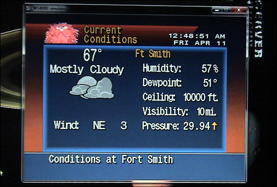
Everybody, meet the WeatherStar 4000. Or at least my computer acting like the WeatherStar 4000 and pulling weather data from right now from the National Weather Service’s services. These were the actual temperatures, forecast conditions, etc. at the time the photos were taken.
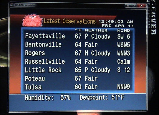
The emulator can be configured and customized to a ridiculous degree – and it can run as a fullscreen graphic in its native 640×480 graphics mode. One could conceivably upscale this and put it on the air. (Yeah, I know – one of these days, I will stop thinking about how to put stuff on the air. I like making stuff and putting it out there. I was born way too early.)
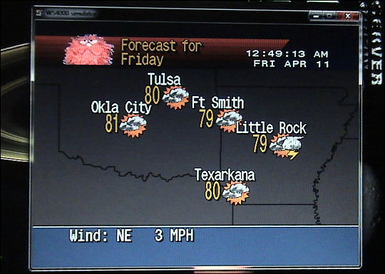
The configuration is the extremely tricky part. You have to know the forecast zone and ASOS station address of every city you plan to localize your display to. ASOS stations are automated service observation systems – the little gadgets found at most airports of even moderate size – but they’re also legacy systems, since supplanted by AWOS and AWSS units. I found that the WeatherStar 4000 emulator sometimes had trouble drawing a complete data set, or any data at all, from newer automated weather stations: in short, they were deployed more recently than the WeatherStar units were, so I thought there might be compatibility issues. Curiously, other AWSS/AWOS addresses returned full usable data. When it comes to the regional forecast/condition map like this, you have to manually place the cities on the map, because the ASOS stations don’t automatically report their longitude and latitude (they’re really not supposed to move once sited!). If any of the ASOS addresses in your config file aren’t correct, the emulator chokes on the incorrect data and won’t launch.
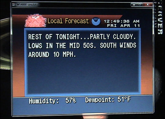
So far, so good – the forecast is right on the money.
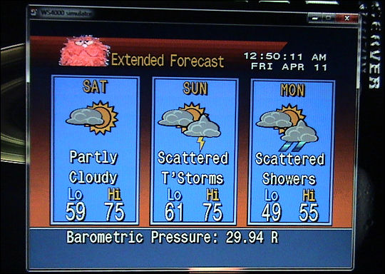
One of the best things about the WeatherStar 4000 was its suite of completely unambiguous graphics and its easy to understand presentation. I suppose that’s two things, then. Two of the best things. The WeatherStar 4000 emulator is not using any of the actual machine’s proprietary code – even the graphics have been recreated from the ground up by fans of the vintage Weather Channel “look” (and yes, there were people who were that into it).
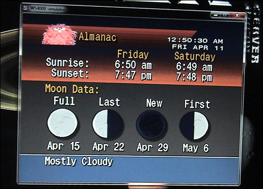
Perhaps the most dangerous part of all this is the sheer customization of it all. I’m sure you’ve noticed that a certain famous fiddygibber has replaced the Weather Channel logo that used to sit at the top of the screen. But that graphic can be anything (within certain dimensions and a certain filesize). The program also has provisions for a music playlist and even custom voice-overs! You just get the files ready, point it toward the appropriate directories, and let rip. The thing is a freakin’ all-local-weather TV station. You can program crawls to run whatever text you want – potentially even commercial in nature – at regular intervals.
Who would need this in this day and age? Hell, given what the Weather Channel has become in the here and now, who doesn’t need it? I don’t know, really. It’s had its day. I might even try to run it on a laptop at OVGE this year. Why not? It’s vintage technology!
And sometimes vintage technology does things in a less-cluttered, more concise way than we do it now.


Oh, a couple more things. Does it do local radar? Absolutely it does.
Now, the local radar has to be tweaked a bit – it grabs the raw radar data in its coarsest form and throws it up there. You can tweak it to ignore any data below a certain threshold (the defaults are 05DBZ, 10DBZ, and 15DBZ). I always used to wonder why the Weather Channel local radar looked so different from what the various TV stations’ radar showed – this is why. If you leave it unfiltered, it looks like it’s raining everywhere. It doesn’t improve until you filter out everything below 15DBZ.
Anyway, we now go back to Burchuss with your weekend forecast.
It looks like I’ll find out Sunday if it does the full-text-screen-on-a-red-background thing for severe weather advisories; I’ll try to remember to snap a picture.