TIROS-8
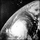 NASA and the United States Weather Bureau launch the eighth experimental TIROS weather satellite, TIROS-8. With TIROS-7 still fully operational, TIROS-8 expands coverage of Earth’s weather (including early detection and tracking of Hurricane Betsy, the first hurricane in American history to cause over $1,000,000,000 in damage) and tests new technology, including a high resolution, slow-scan imaging system. TIROS-8 is the second longest-lived of the early experimental TIROS satellites, remaining in service for three and a half years.
TIROS-7
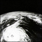 NASA and the United States Weather Bureau launch the seventh experimental TIROS weather satellite, TIROS-7. In addition to observing weather on Earth, TIROS-7 carries instruments to measure electron activity in Earth’s vicinity and to measure the temperature of space. Enhancements designed to extend the satellite’s life prove to be wildly successful: TIROS-7 is the longest-lived of the experimental TIROS series, remaining in service for five years (and, critically, five hurricane seasons).
TIROS-6
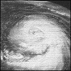 NASA and the United States Weather Bureau launch the sixth experimental TIROS weather satellite, TIROS-6. Launched specifically to allow for better detection of storms during the 1962 Atlantic hurricane season, TIROS-6 has a full workload within days of launch as Hurricane Daisy forms in the Caribbean Sea and makes its way to New England. TIROS-6 finally provides a successful test for NASA’s attempts to keep a weather satellite in service for long-duration missions, lasting over a year in orbit.
TIROS-5
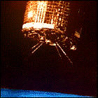 NASA and the United States Weather Bureau launch the fifth experimental TIROS weather satellite, TIROS-5. Further refinements to the basic TIROS satellite system are made, including new systems designed to keep the satellite in orbit – and in service – for a much longer period of time. A problem with the Delta rocket used to launch TIROS-5 puts the satellite in an elliptical orbit which is maintained for less than six months.
TIROS-4
 NASA and the United States Weather Bureau launch the fourth experimental TIROS weather satellite, TIROS-4. Further refinements to the basic TIROS satellite system are made, and after TIROS-3’s discovery of a hurricane in the Atlantic well before it his the US, new enhancements are introduced specifically for early hurricane detection. TIROS-4 remains in orbit for less than six months.
TIROS-3
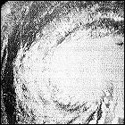 NASA and the United States Weather Bureau launch the third experimental TIROS weather satellite, TIROS-3. Further refinements to the basic TIROS satellite system are made, but one of the satellite’s two television cameras fails within days of going into service. TIROS-3 proves the future life-saving potential of weather satellites by giving Earthbound meteorologists advance warning of the formation and strengthening of Hurricane Esther well before it makes landfall on the east coast of the United States. TIROS-3 is operational for less than a year.
TIROS-2
 NASA and the United States Weather Bureau launch the second experimental TIROS weather satellite, TIROS-2. Though almost identical to its short-lived predecessor, TIROS-2 is outfitted with a new stabilization system which uses detection of Earth’s magnetic field to properly orient the satellite. TIROS-2 functions successfully for just over one year.
TIROS-1
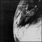 The very first weather satellite, TIROS-1, is launched by the United States. Built under contract by RCA, the nearly-300-pound satellite’s black & white cameras offer the first view of Earth’s cloud systems and weather patterns from orbit. Tiros-1 remains operational for just 78 days, but proves the viability of relying on satellites for weather observation and forceasting.
Weather radar, pre-Doppler
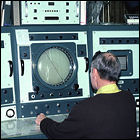 The U.S. Weather Bureau installs the first WSR-57 weather radar in what in intended to eventually be a network of weather radars spanning the entire country. Derived from World War II radars, the WSR-57 is first installed at the National Hurricane Center in Miami, Florida, where it offers as much as two days’ advance notice of storms approaching the Florida coast in the years before weather satellites. This radar remains in service until 1992, when it is literally ripped off the NHC’s roof by the winds of Hurricane Andrew. It is later replaced by a WSR-88 NEXRAD radar, though by that time satellite imagery has become the primary means of remotely detecting major tropical weather events.
Doppler weather radar
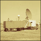 The U.S. Weather Bureau uses a mobile Doppler radar transmitting and receiving in the 3cm bandwidth to measure wind speeds in a tornado striking El Dorado, Kansas, which kills 13 people living in that city. With Doppler radar’s ability to detect and measure the velocity of wind and rain moving toward and away from the radar itself, it is ideally suited for tornado observations and detection. This mobile radar is later given to the Bureau’s National Severe Storms Laboratory in the 1960s, and is the beginning of a lengthy research program that culminates in the nationwide rollout of Doppler-based NEXRAD (Next Generation Radar) in the 1990s.
The Severe Local Storms Warning Service
 Formerly the Weather Bureau-Army-Navy Severe Weather Unit, the recently-renamed Severe Local Storms Warning Service (SELS) relocates from Washington D.C. to Kansas City, Missouri. The new location puts the SELS closer to the American midwest, a hotbed of severe weather during the spring months, as well as placing it in close proximity to a major telecommunications hub (at this point, the SELS is reliant almost entirely on teletype transmissions). Additionally, precise definitions of what constitutes a severe thunderstorm (winds in excess of 50mph, wind gusts in excess of 75mph, and hail in excess of an inch in diameter) are established, as well as a concerted effort to target its weather bulletins to more precise geographic regions.
Hook echo: first tornado detected by radar
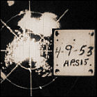 Using a World War II-era aviation radar system, Illinois State Water Survey electrical engineer Donald Staggs makes the first radar-based detection of a nearby tornado, part of a tornado outbreak striking in and near Champaign, Illinois. The “hook echo” is the distinctive radar signature of a rapidly evolving small-scale cyclone developing from the larger radar signature of its parent thunderstorm. Continued observations confirm that this is the “radar shape” of a forming tornado, an invaluable piece of information for forecasters on the forefront of severe weather prediction.
Tornado Bulletin #2
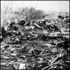 The newly formed Weather Bureau-Army-Navy Severe Weather Unit‘s second attempt to warn the public that tornado formation is possible within a specific area strikes paydirt. Again covering a large area including portions of Texas, Oklahoma, Arkansas, and Louisiana, later expanded to include states east of this area, this forerunner of modern tornado watches is right on the money, predicting an outbreak of more than 20 tornadoes in Arkansas, Missouri, Mississippi and Kentucky. Despite the advance notification, the Severe Weather Unit has work to do in educating the public about its bulletins: over 200 deaths still occur as a result of the tornadoes.
Baptism by fire…and wind
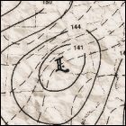 The newly formed Weather Bureau-Army-Navy Severe Weather Unit hits the ground running with its first tornado bulletin issued to the general public for portions of Texas, Oklahoma, Arkansas and Louisiana. This forerunner of the modern tornado watch is a misfire, however: the only two confirmed tornadoes occur, both outside the area covered in the bulletin. Critics within the Weather Bureau express doubt that such bulletins will ever be of use to the public, and may instead spark panic among the public; this attitude will all but disappear within three years.
Weather Bulletin!
 The U.S. Weather Bureau (forerunner of the National Weather Service) inaugurates the Severe Weather Unit at the WBAN (Weather Bureau-Army-Navy) Analysis Center in Washington D.C. Armed with recent research and decades of past research into the formation and behavior of severe thunderstorms and tornadoes, this is the first attempt to offer the military’s growing severe weather prediction capability to the American public. In these early days, before the adoption of specific types of weather watches, the WBAN Severe Weather Unit issues weather bulletins for tornadoes and severe thunderstorms alike; by early 1953, the Severe Weather Unit also issues “outlooks” with more general predictions about the probability of severe storms.
Weather Radio: all weather, all the time
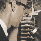 The U.S. Weather bureau signs on radio station KWO35, located at New York’s La Guardia Airport, broadcasting weather forecasts primarily for the benefit of pilots. Not targeted for public consumption, the experimental station broadcasts for several hours a day at a frequency of 162.55Mhz, outside of the spectrum reserved for FM radio. A similar station on the same frequency will later sign on at Chicago’s O’Hare Airport in 1953, again mainly for the consumption of airline pilots. Marine forecasts are added later, and the system helps the Weather Bureau prevent its local forecasters from being overwhelmed by requests for “personalized” weather reports for pilots. These two stations are the precursor for the nationwide weather radio network operated by the Weather Bureau’s successor agency, the National Weather Service.